Running extreme trails in the Galicica National Park - Ohrid, Macedonia
I’ve been fortunate in my work travels to have so many opportunities to travel to amazing locations across Europe for extreme trail runs. These experiences gave me the context to appreciate the beauty, and difficulty, of the trails in Ohrid, Macedonia. Ohrid is one of the best locations for an ultrarunning destination in Europe given the closeness of extreme runs to the town, the beautiful clear lake to relax in after a difficult run, and the quaint town on the lake with tourist sites, great food, and excellent views. Once you are there, you can see why it’d been selected as a UNESCO World Heritage Site.
This trip started with a flight to Amsterdam for a friend of mine’s wedding in Limburg, Netherlands. While researching a run for the wedding weekend, I came across The Dutch Mountain Trail which starts near the town of Kerkrade, Netherlands. I ran to one peak nearby, Wilhelminaberg, on the trail with clear views of the surrounding countryside. This area turns out to be very popular for biking because of these hills. I’ll add The Dutch Mountain Trail to my bucket list for another trip!
Amsterdam turned out to be a good place to start my trip to Ohrid. It can take some work to find flights to Ohrid since the flight schedules vary each day. I was fortunate to find a direct flight to the Ohrid St. Paul the Apostle Airport on TUI Airlines at 5am Tuesday the week after the wedding. While it was an early flight, it worked out well to get to Ohrid to have the day to explore the town and do research on the trails. The drive to the town from the airport is only 20 minutes, so very little time is lost in the transit.
I stayed at the Mr. I Boutique Hotel & Bar because of its location right on the lake and closeness to the shopping district and old town. The rooms are unique in that they are named after actors. I stayed in the Monica Bellucci room since it had a lake view. If you stay in a lake view room, be sure to bring ear plugs, since the crowds come out later in the evening into the late night in Ohrid. The balcony was great in the morning to enjoy coffee, but when I was there, it was too hot to sit in the afternoon sun.
The basis of my ultrarunning plans was the course tracks for the Ohrid Ultra-Trail race. This ultramarathon race offers distances of 20k, 40k, 60k and 100k. Each race has a decent elevation gain of 1100m, 2,000m, 3,350m, and 5,000m, respectively. I decided that the 40k distance would be a suitable distance, and that I could stretch the run out to be 50k based on the other areas I saw in the Galicica National Park. My favorite app for researching trails, and for navigating while on the trails, is Gaia GPS. I’ll get into more detail on this later, but I wouldn’t do these trails on your own unless you have a good mapping app like Gaia GPS, with the maps downloaded, since there isn’t cell reception on much of the trail.
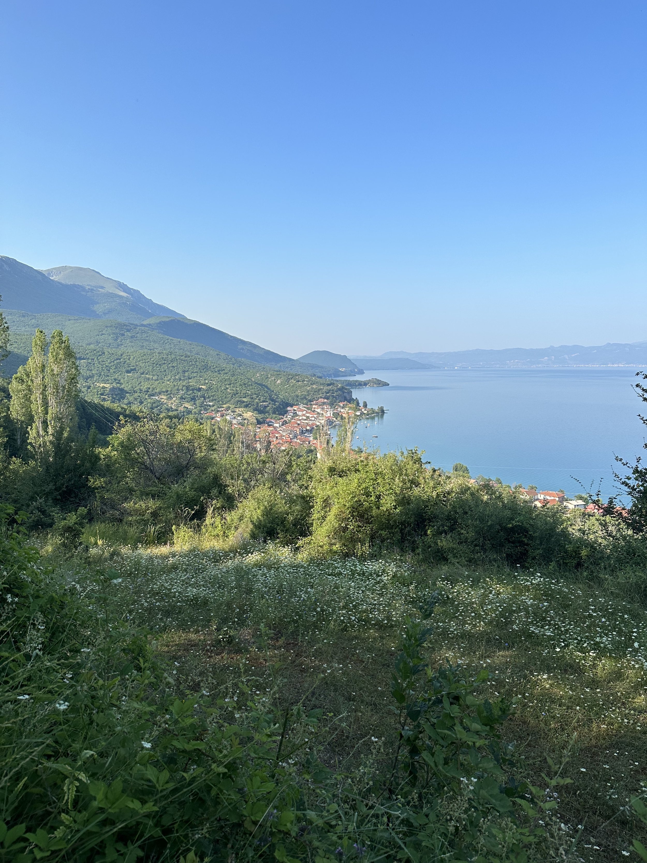
The day before the run, the temperature got into the mid-90s (mid-30s Celsius), so I decided it was important to start early to beat the heat with an early start. The day started with a 20 minute drive to one of the lake villages, Peshtani. The road from downtown Ohrid goes right along the lake. At one point I thought that I could run directly from town to Peshtani, but after I was there and looked at Google street view, I realized that this road wouldn’t be good for running given the almost complete lack of a berm on either side of the road.
The trail starts directly from a parking lot along the road and winds for about a mile through the town before it transitions to the mountain trail. This trail was nearly straight up the mountain, with some small switch backs, but mostly steep trails. The elevation gain in the first 4.5 miles (7 km) is about 3600 feet (1100m). The trail affords great views of the lake for much of the climb, and there is also a lot of variation in the terrain, which also includes portions through tunnels of dense foliage. The mountain was also in the shade of the rising sun, so the run stayed cool, but there was also quite a bit of humidity, so I had to keep my sunglasses off since they would fog up.
Getting near the peak of the mountain, bees started to buzz around my head. I thought that they would eventually leave me as I got into the alpine region away from the forest. But, I couldn’t have been more wrong. In addition to the bees, these very large horse flies joined in to the swarm around my head. Whenever I would stop for the briefest of moments, the flies would land on me and bite. They were especially annoying around my watch for some reason, wanting to burrow under the band. It wasn’t until I was near the bottom of the trail 5 hours later that their buzzing around me finally let off.
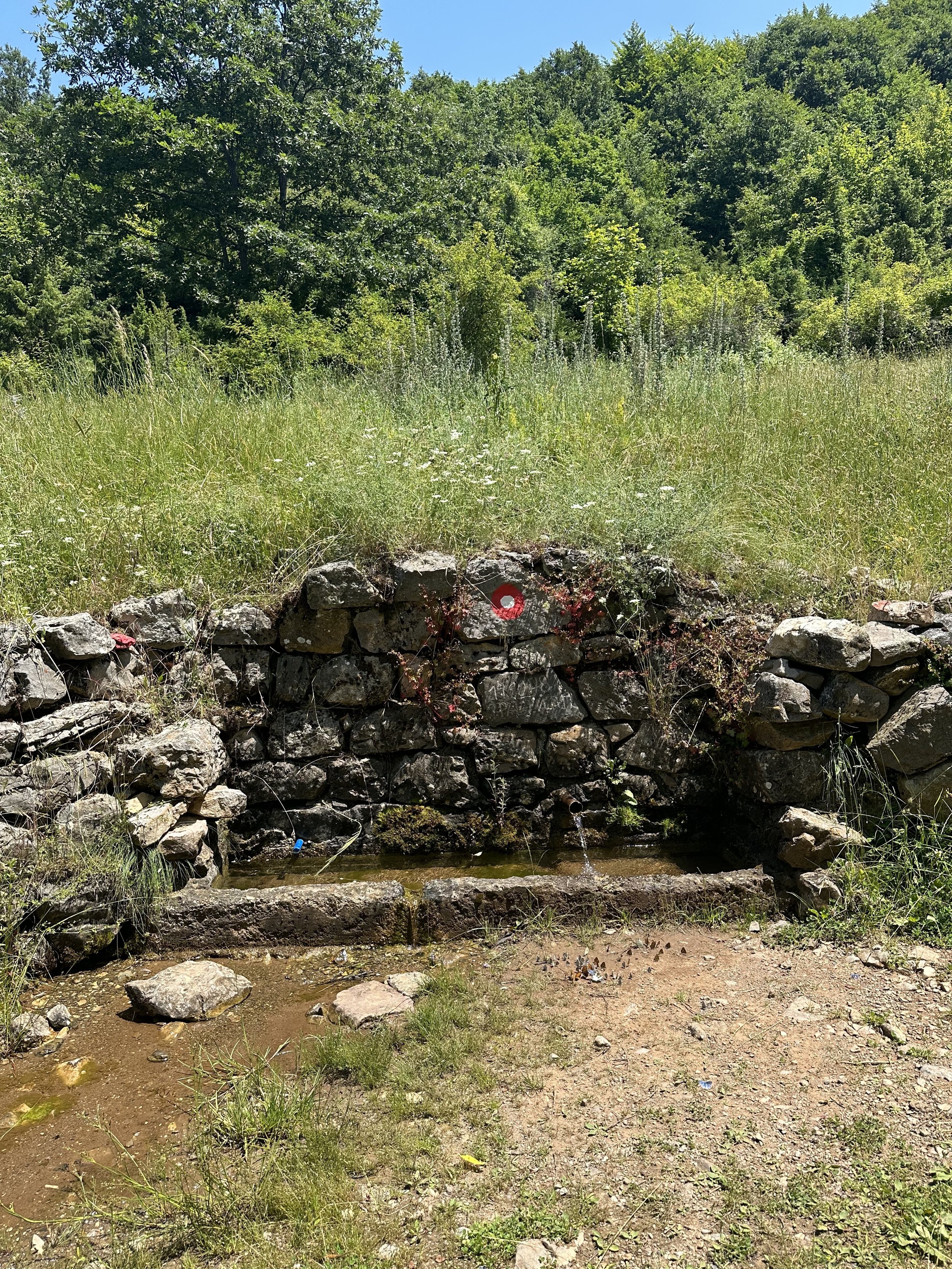
The trail to the top was very clear where to go and had decent trail markings. The trail also is used by the local farmers to access some of their properties higher up the field, so that part of the trail wasn’t overgrown. This easy to follow part of the trail changed once I got closer to the peak of Chumo Vlaga (Bugarska Chuka). From here, to nearly the end of the trail, the trail marking was inconsistent with lots of dense, overgrown foliage in many parts.
Ohrid received a lot of rain this year, which is unusual for the region, so it’d be more typical for the meadow grasses to be dead. However, when I ran it, there was dense tall grass as well as one area with the thickest nest of nettle plants I’ve ever seen. I had no choice but to wade through the nettles, and since I was in shorts, it left me with the entirety of my legs burning. The burning sensation lasted into the evening, even after washing my legs with lots of soap which I read should neutralize the stinging. The only benefit of the pain during this part of the run was that I wasn’t focused on the bees and large flies incessantly buzzing around me.
The trail is extremely beautiful, since from the peaks one can see Lake Ohrid and in some places also Lake Prespa on the other side of the mountain. There is a nice mix of dense forest trails, which for me were the most runnable portions since they were not so technical, tall grass in tree lined valleys, and ridge trails with commanding views of the lake towns, and even Albania! In most runs I do there are enough portions of runnable less technical trail that I can get in some good running. On this trail, it wasn’t the case due to the rocky terrain, but also because the markings were so hard to find and I was constantly checking my map.
I noted earlier that having a trail mapping tool, such as Gaia GPS, with downloaded maps is critical for this run. There were portions where there were neither trail markings that I could find nor evidence of anyone coming through that area recently. Having to constantly check the maps made for extremely slow going, and I realized that I wasn’t going to be able to run the full 24 miles (40 km) in a safe manner. I also didn’t see any places to get water high up on the mountain, and the bright sun and 90+ Fahrenheit (30+ Celsius) degree temperature were taking a toll on me. As such, I decided to not follow the full 40k tail, and just aim for about 18 miles (30km) since I saw on the map where I could make a shortcut. One irony of the trail markings is that in an area where they seemed especially good, I blindly followed them and ended up connecting back to an early portion of the trail and had to backtrack about a mile. My wrong turn was caused by a typical trail runner mistake of getting distracted and looking the wrong direction right at the point you are supposed to make a turn. The thing that distracted me was an unmarked sign laying on the ground that happened to be pointing the wrong direction.
The Ohrid Ultra-Trail is held in May, which is likely a much more ideal time to do this run since the temperature will be much lower, the grasses not so high, and if you run it after the Ultra Race, the trail should be much more clear, enabling a much quicker run without having to check the map so constantly.
The next day after my run, I enjoyed walking the grounds of the Monastery of Saint Naum and a day in the shade next to the cool crystal clear waters of Lake Ohrid. The water is exceptionally clean since the lake is fed by a spring that flows through the grounds of the monastery. One can even take boat rides into the headwaters of the spring. There are cafes where you can have lunch or a coffee along the lake.
I highly recommend a trip to Ohrid, Macedonia to run its trails, tour the historic sites, and have excellent food at one of the many restaurants on the lake. Whether you are looking for an ultra-distance run, or just a challenging trail run that starts directly from town, Ohrid has great options for you. There are plenty of trails to follow within the Galicica National Park for multiple days if you have the time and endurance!
Tracks
Start: Peshtani, North Macedonia
End: Gas Station - Ohrid, North Macedonia
Distance: 17.67 miles / 28.5 km
Elevation: 5,174 feet / 1,577 meters